


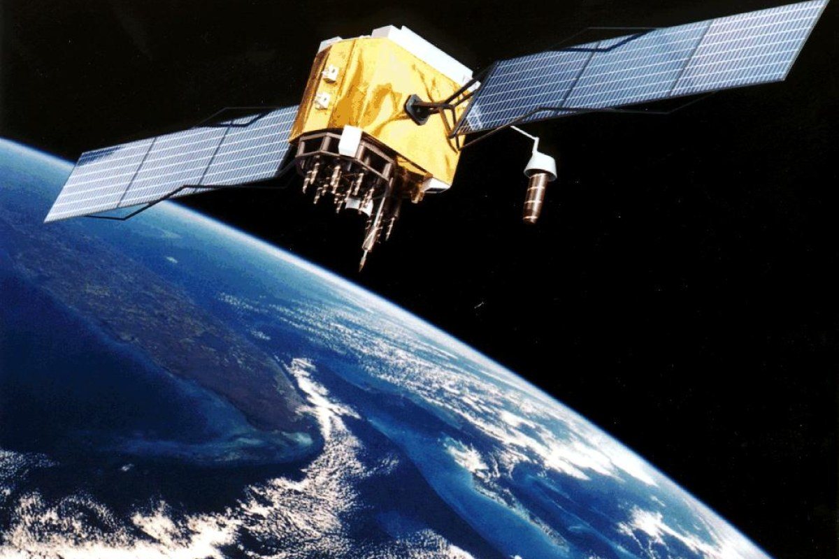
Opening a map on a smartphone and seeing a blue dot exactly where you stand feels effortless, but it is the result of one of the most remarkable engineering systems ever built. Dozens of satellites orbit the Earth, each carrying extremely precise clocks and constantly broadcasting radio signals. Your phone, car or watch listens to these signals and, using careful timing and geometry, works out its position to within a few metres. This article explains how satellite navigation works, why time is at its heart and how different global systems cooperate.
GPS and its siblings
The Global Positioning System, or GPS, was developed by the United States Department of Defense and became fully operational in the 1990s. Although it began as a military project, it has long been freely available for civilian use. GPS is one of several Global Navigation Satellite Systems, collectively known as GNSS:
- GPS – operated by the United States.
- GLONASS – operated by Russia.
- Galileo – the European Union's civilian-controlled system.
- BeiDou – operated by China.
Regional systems also exist, such as Japan's QZSS and India's NavIC. Most modern phones receive signals from several of these constellations at once, which increases the number of visible satellites and improves accuracy, particularly in cities where tall buildings block parts of the sky.
The core idea: measuring distance with time
Each navigation satellite continuously transmits a signal that includes the exact time it was sent and information about the satellite's orbit. A receiver on the ground notes when the signal arrives. Because radio waves travel at the speed of light, the difference between sending time and arrival time reveals the distance to the satellite.
Knowing your distance from one satellite places you somewhere on the surface of an imaginary sphere around it. A second satellite narrows this to the circle where two spheres intersect, and a third reduces it to two possible points, one of which is usually far out in space and can be dismissed. This process is called trilateration.
There is a catch, however. The satellites carry atomic clocks that are astonishingly accurate, but a phone contains a cheap quartz clock. Because light travels about 300,000 kilometres per second, a timing error of just one millionth of a second would produce a position error of around 300 metres. The solution is elegant: the receiver uses a fourth satellite and treats its own clock error as an unknown to be solved alongside latitude, longitude and altitude. With four or more satellites, the receiver can calculate both where it is and what the precise time is.
Relativity in your pocket
Satellite navigation is one of the few everyday technologies where Einstein's theories of relativity have practical consequences. Satellites move quickly relative to the ground, which according to special relativity makes their clocks tick slightly slower. They also sit higher in Earth's gravitational field, which according to general relativity makes their clocks run slightly faster. The gravitational effect is larger, so overall the satellite clocks gain a small amount of time each day compared with clocks on Earth. Engineers correct for this; without the correction, position errors would quickly accumulate.
Sources of error and how they are reduced
Even with perfect clocks, several factors affect accuracy:
- Atmospheric delay – signals slow slightly as they pass through the ionosphere and troposphere.
- Multipath – signals bounce off buildings or mountains, making the path longer than the direct line.
- Satellite geometry – if visible satellites are clustered in one part of the sky, the calculation becomes less precise.
- Obstructions – tunnels, dense forests and indoor spaces weaken or block signals entirely.
Modern receivers use several techniques to compensate. Dual-frequency receivers compare signals on two frequencies to estimate and remove ionospheric delay. Augmentation systems, such as Europe's EGNOS, broadcast correction data for a region. Smartphones also combine satellite data with Wi-Fi and mobile network information, as well as motion sensors, to estimate location when satellite signals are weak – a technique often called assisted GNSS.
For professional uses like surveying and precision agriculture, methods such as Real-Time Kinematic positioning compare signals with a nearby fixed reference station, achieving accuracy at the centimetre level.
Far more than maps
Navigation is the obvious application, but satellite systems also serve as the world's most widely available precise clock. Telecommunications networks, power grids, financial transaction systems and scientific instruments rely on GNSS timing to stay synchronised. This dependence is one reason governments invest in multiple independent systems and backup technologies, and why interference with satellite signals – known as jamming or spoofing – is treated as a serious concern for aviation and shipping.
The next time the blue dot appears on your screen, it is worth remembering what lies behind it: a network of satellites, clocks accurate to billionths of a second, corrections for the curvature of space-time and a receiver solving equations many times a second – all so you can find the nearest café.
What's Your Reaction?
 Like
0
 Dislike
0
 Love
0
 Funny
0
 Wow
0
 Sad
0
 Angry
0











Comments (0)